What do the results mean?
Shoreline erosion is a loss of the land due to the removal of beach and dune material. It can result in a loss of habitat (e.g. intertidal sand flats for shorebirds), infrastructure (threatening boat ramps, buildings and other shoreline assets), important geomorphic features such as the silt jetties, and lead to increased suspended sediments in the water column. In the case of the outer barrier (the narrow strip of land separating the Gippsland Lakes from Bass Strait) coastal erosion processes (including sea level rise and an increased frequency and intensity of storms) could lead to a temporary breaching of the barrier dunes, resulting in changes to the morphology and hydrology of the local area, over a variety of timeframes.
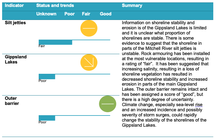
Information on shoreline stability and erosion in the Gippsland Lakes is limited and it is unclear what proportion of shorelines are stable. There have been a small number of studies in recent years on the silt jetties, climate change influences and geomorphology. The information is mostly qualitative, and the assessment of condition presented here is based on expert opinion. It has been suggested that increasing salinity, resulting in a loss of shoreline vegetation, has resulted in decreased shoreline stability and increased erosion. Climate change, especially sea-level rise and an increased incidence and possibly severity of storm surges, could rapidly change the stability of the shorelines of the Gippsland Lakes.
Technical Reports
Case Study
The Mitchell River silt jetties
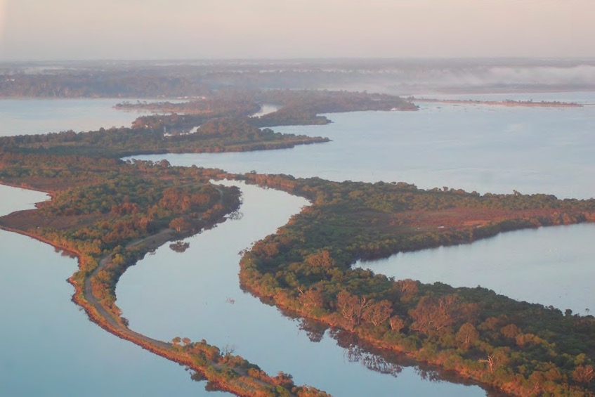
The Mitchell River silt jetties are long, narrow tracts of land that extend almost eight kilometres into Lake King, forming the barrier between Lake King and Jones Bay. They are second in size only to those of Mississippi River that extend into the Gulf of Mexico and are considered significant both nationally and internationally as one of the finest examples of this type of landform in the world.
The origin of the Mitchel River silt jetties has been the subject of scientific debate, with questions raised about how such an extensive formation of sediment could have accumulated from such a relatively small river (Bird 1978). However, the most common theory is that they were formed from the deposition of sediments from the Mitchell River as a type of river delta, with the low wave energy in the waterbodies prior to the permanent opening to the Southern Ocean, accounting for their unusual size (Rosengren 1984).
Since the 1900s, there has been considerable erosion of the silt jetties and surrounding shorelines, with much of the extensive reed beds that once protected these shorelines now gone. In addition, these important features, which provide habitat for a variety of plants and animals, are at risk from sea level rise and climate change.
Parks Victoria is leading a collaborative project to protect the silt jetties through a number of on ground management actions and erosion control. This program has seen the establishment of rock armouring along the jetties in the areas most at risk of erosion, improving shoreline stability and protecting this asset for future generations.